Skip to content
MDCBridge

Madagascar Discovery Canada Bridge

The great scientific crossing of northern Madagascar

From Diego-Suarez to Vohémar, Sambava, Andapa and Nosy Be: eighteen days to read a land where geoscience, biodiversity, hydrology, agroecology and heritage meet.

Duration
18 days, 17 nights
Group
6 to 12 travellers
Languages
French and English
Transport
Flights, 4x4 and boat
48°E49°E50°E12°S13°S14°S15°SAntananarivoAntsirananaEmerald SeaAmber MountainRed TsingyAnkaranaBetsiakaAmbilobeDarainaLoky-ManambatoVohémarSambavaAndapaMarojejyNosy Be50 km
The MDCBridge corridor. The dotted arc links SAVA to Nosy Be by cross-country flights.
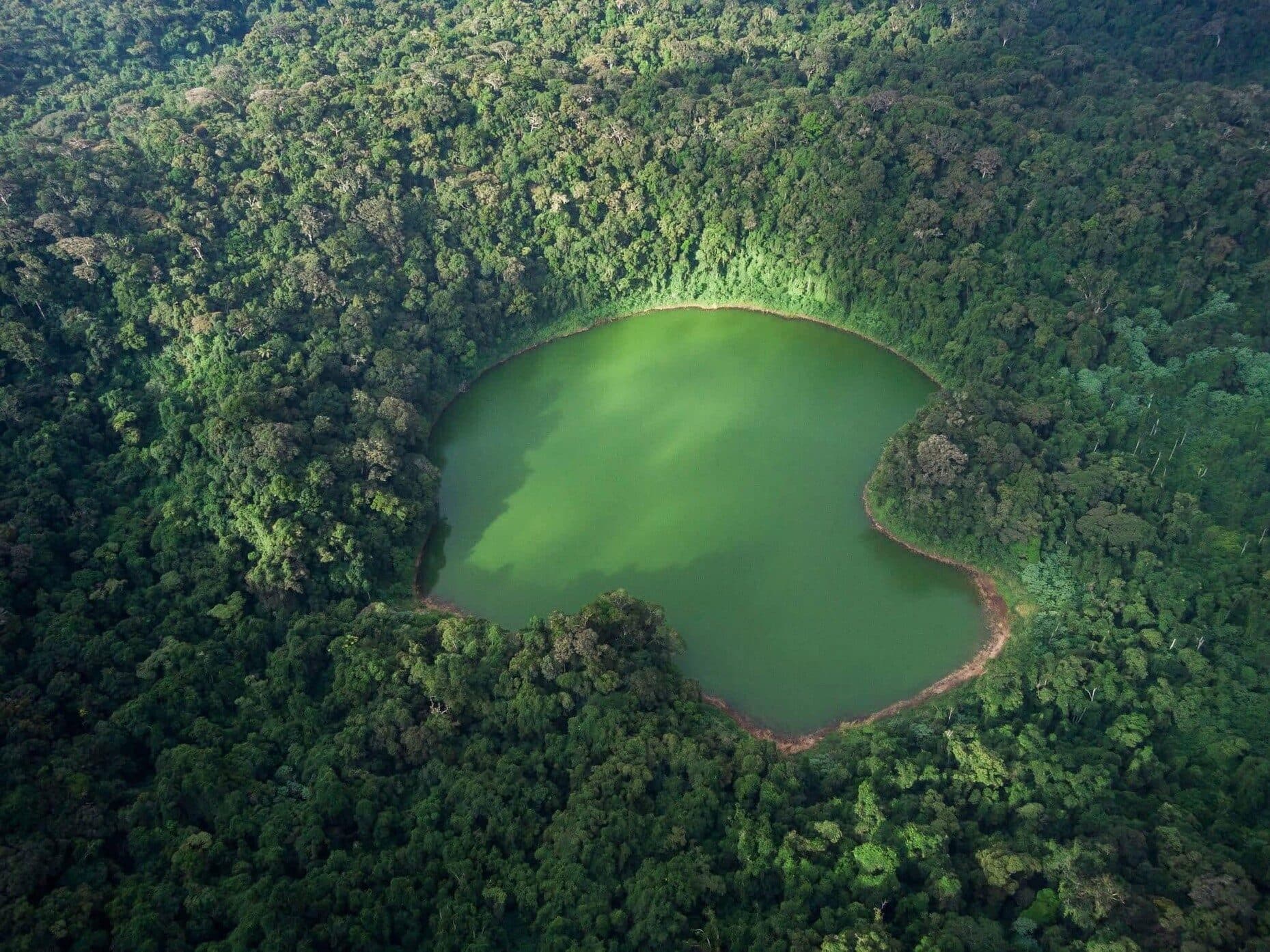
Aerial view of a crater lake in the rainforest of Amber Mountain

Every day produces at least one piece of knowledge: understanding a landscape, documenting a process, meeting a local actor or generating data.

The MDCBridge principle. The journey becomes a structured field experience.

Two branches, one territory

The same corridor can be travelled as a scientific immersion, or activated as a field mission with extra days, measurement protocols, academic supervisors and deliverables.

Branch 1

Discovery & Scientific Expeditions

For travellers who want to understand what they are looking at.

  • Geotourism and scientific tourism
  • Guided expeditions with scientific content
  • Curious researchers, active retirees, alumni, patrons
  • Landscape reading, interpretation and light fieldwork
Branch 2

Science & Field Programs

For teams who come to produce knowledge.

  • Research and university missions
  • Field programs with documented protocols
  • Universities, laboratories, NGOs, institutions
  • Data, authorised sampling, reporting back and partnerships

The North in pictures

From lagoon to mountain forest, some of the landscapes and species the journey lets you observe.

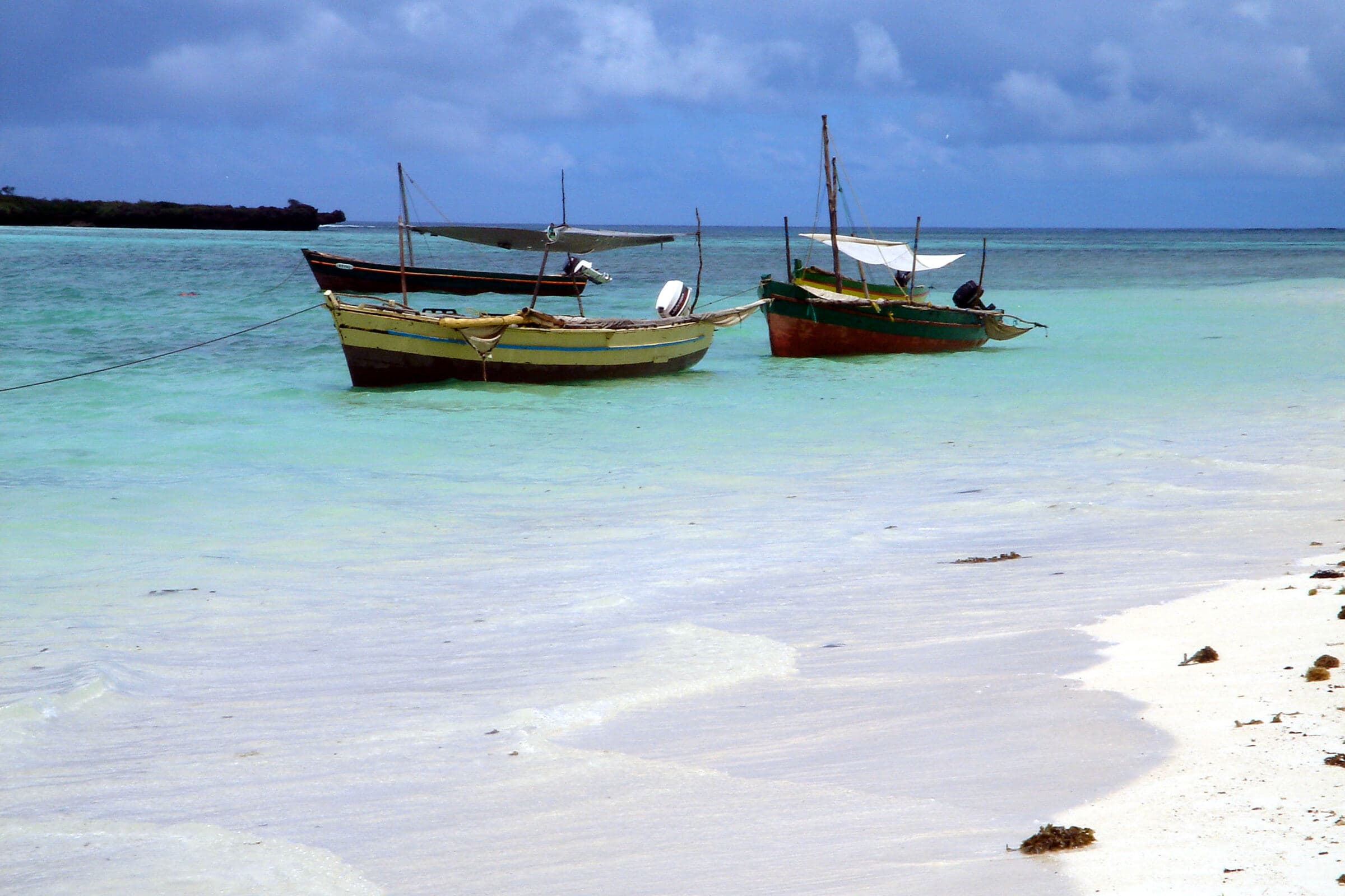
Sailing outriggers moored on the turquoise lagoon of the Emerald Sea
Emerald Sea lagoonPhoto: krishna naudin, CC BY-SA 2.0
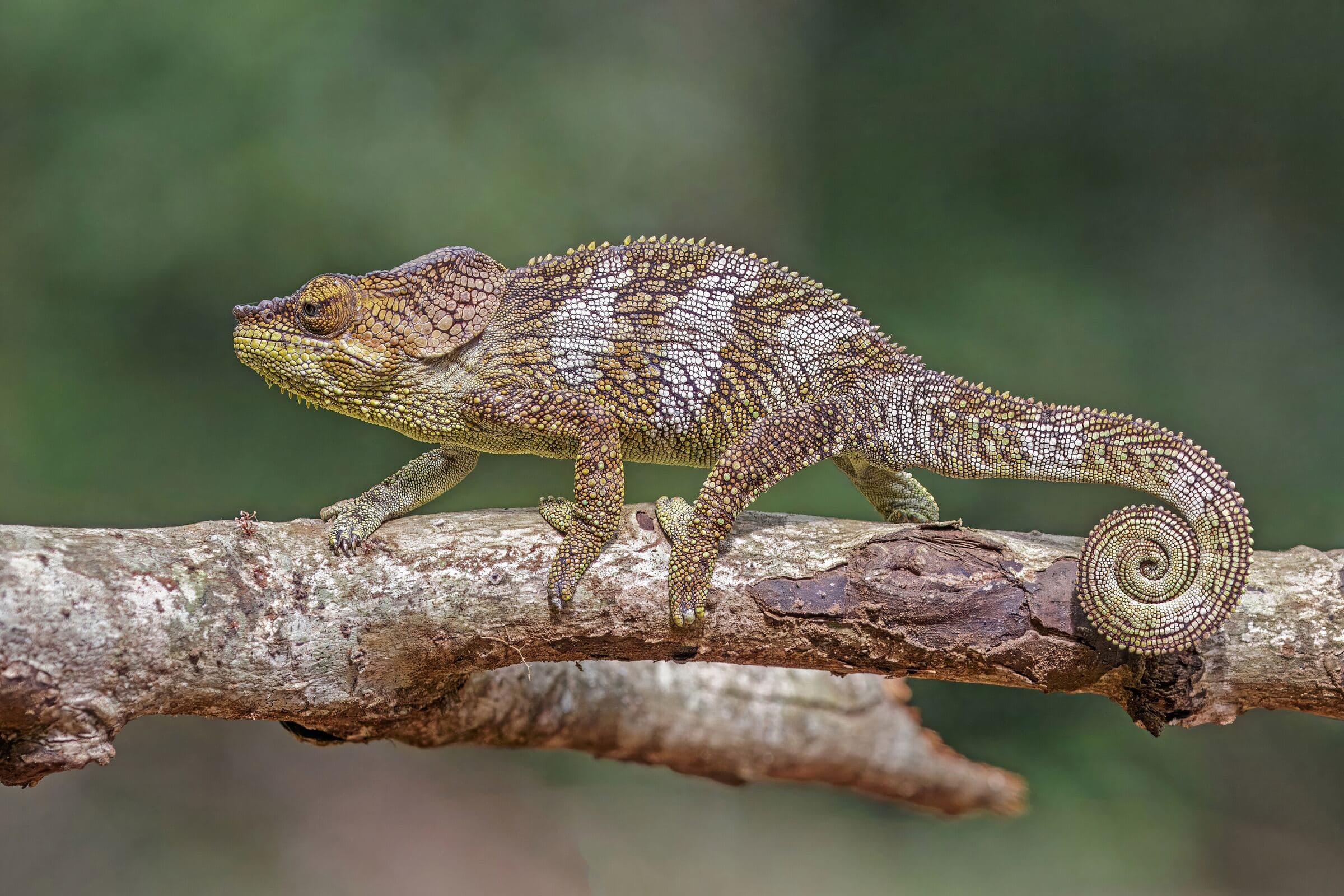
Calumma amber chameleon on a branch
Calumma amber, Amber MountainPhoto: Charles J. Sharp, CC BY-SA 4.0
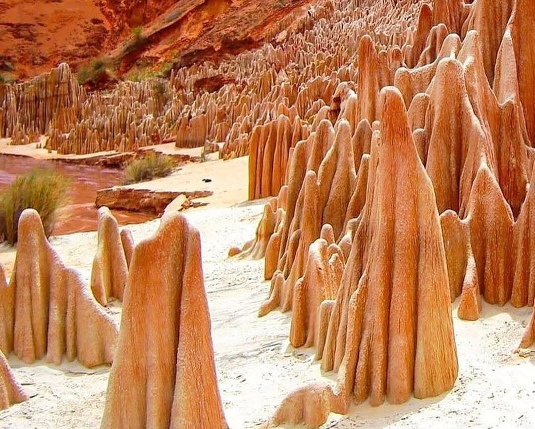
Red laterite cliffs carved by erosion
Red Tsingy of IrodoPhoto: Chirocca77, CC0
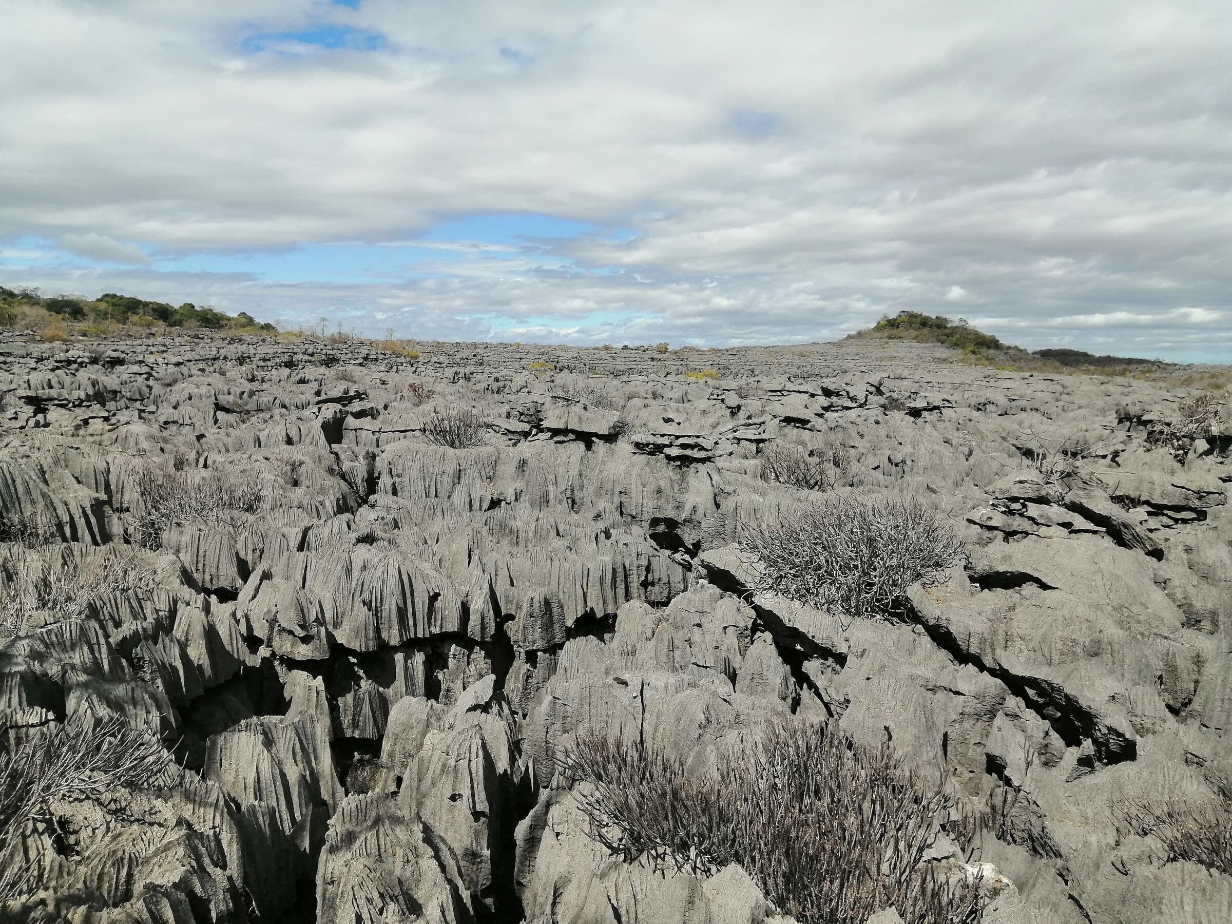
Grey limestone blades and dry vegetation in the tsingy
Limestone blades, AnkaranaPhoto: Marco Schmidt, CC BY-SA 3.0
Forested peaks of the Marojejy massif under a hazy sky
Marojejy massifPhoto: Jeff Gibbs, CC BY-SA 3.0
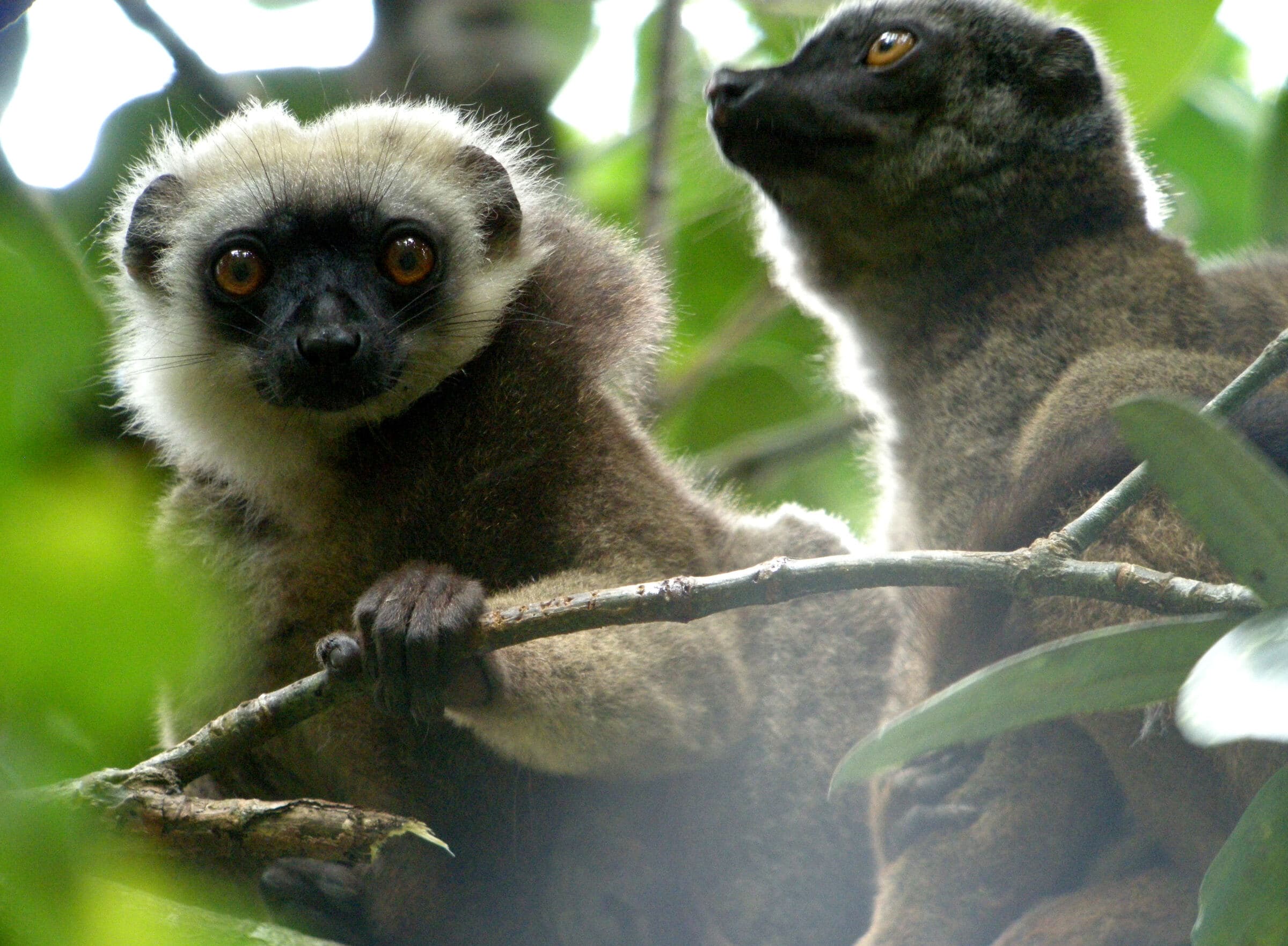
Two white-headed lemurs on a branch
Eulemur albifrons, MarojejyPhoto: Frank Vassen from Brussels, Belgium, CC BY 2.0
Coconut palm leaning over a sandy beach at low tide
Ampasipohy beach, Nosy BePhoto: Diego Delso, CC BY-SA 4.0

An open-air laboratory

Within short distances, the North brings together Precambrian terrains, young volcanic massifs, karstified limestone plateaus, alluvial basins, mangroves, reefs, and both rainforest and dry forest.

This diversity makes truly cross-disciplinary programs possible, from tectonics and metallogeny to ecology, agroforestry and territorial anthropology.

Seven territories, seven field questions.

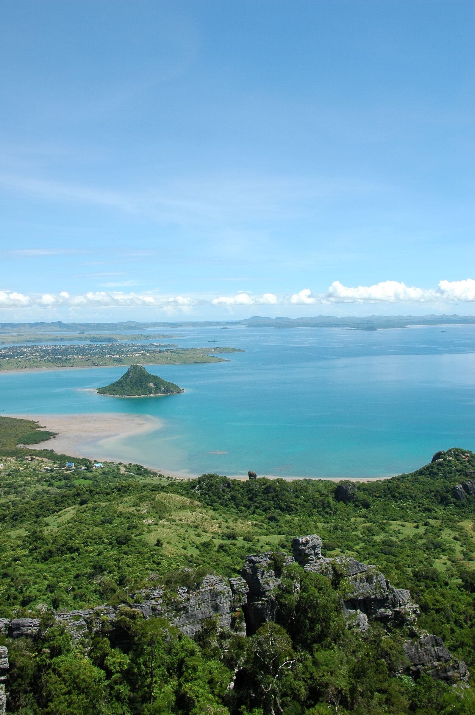
  • Antsiranana bay and the islet of Nosy Lonjo seen from the wooded heights

    Antsiranana and its coast

    Coastal geomorphology, bays, erosion, maritime uses

    How do relief, winds, currents and human settlement shape the coastline?

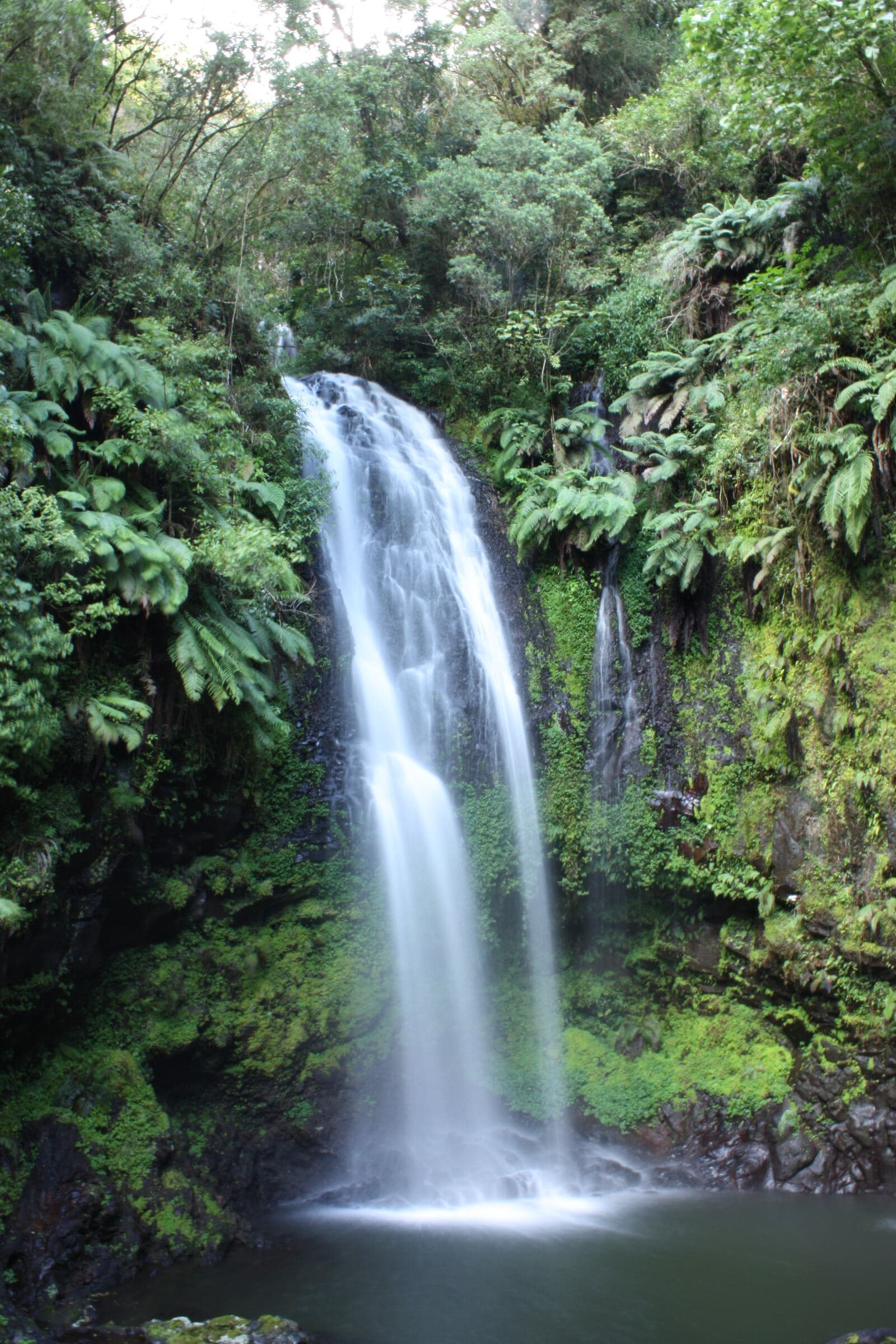
  • Waterfall dropping into a pool in the rainforest

    Amber Mountain

    Volcanism, hydrogeology, rainforest

    How does a volcanic massif work as a water tower and a refuge for biodiversity?

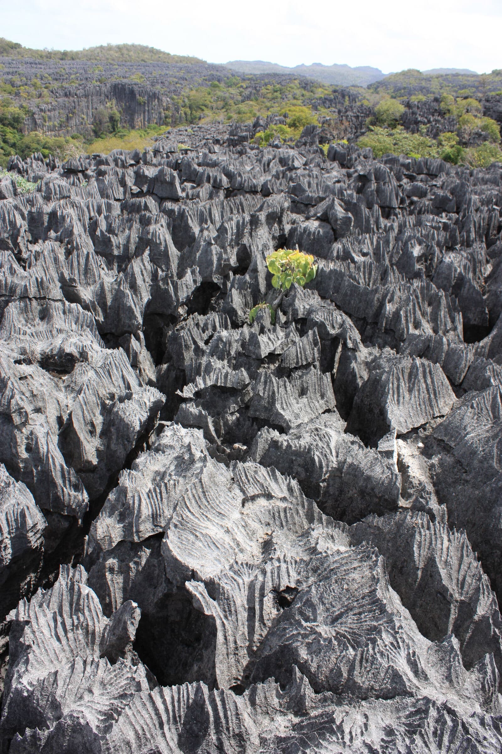
  • Limestone plateau bristling with tsingy under a cloudy sky

    Ankarana

    Jurassic karst, caves, underground hydrology

    How do dissolution, underground drainage and surface landforms fit together?

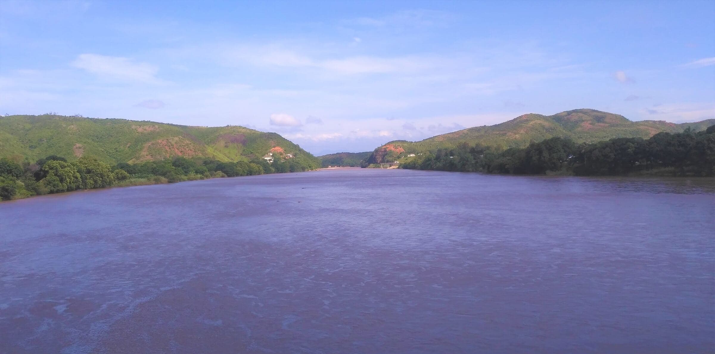
  • Wide river between green hills

    Ambilobe – Betsiaka

    Basement, structures, mineralisation and placers

    How do geology, artisanal mining, formalisation and local development connect?

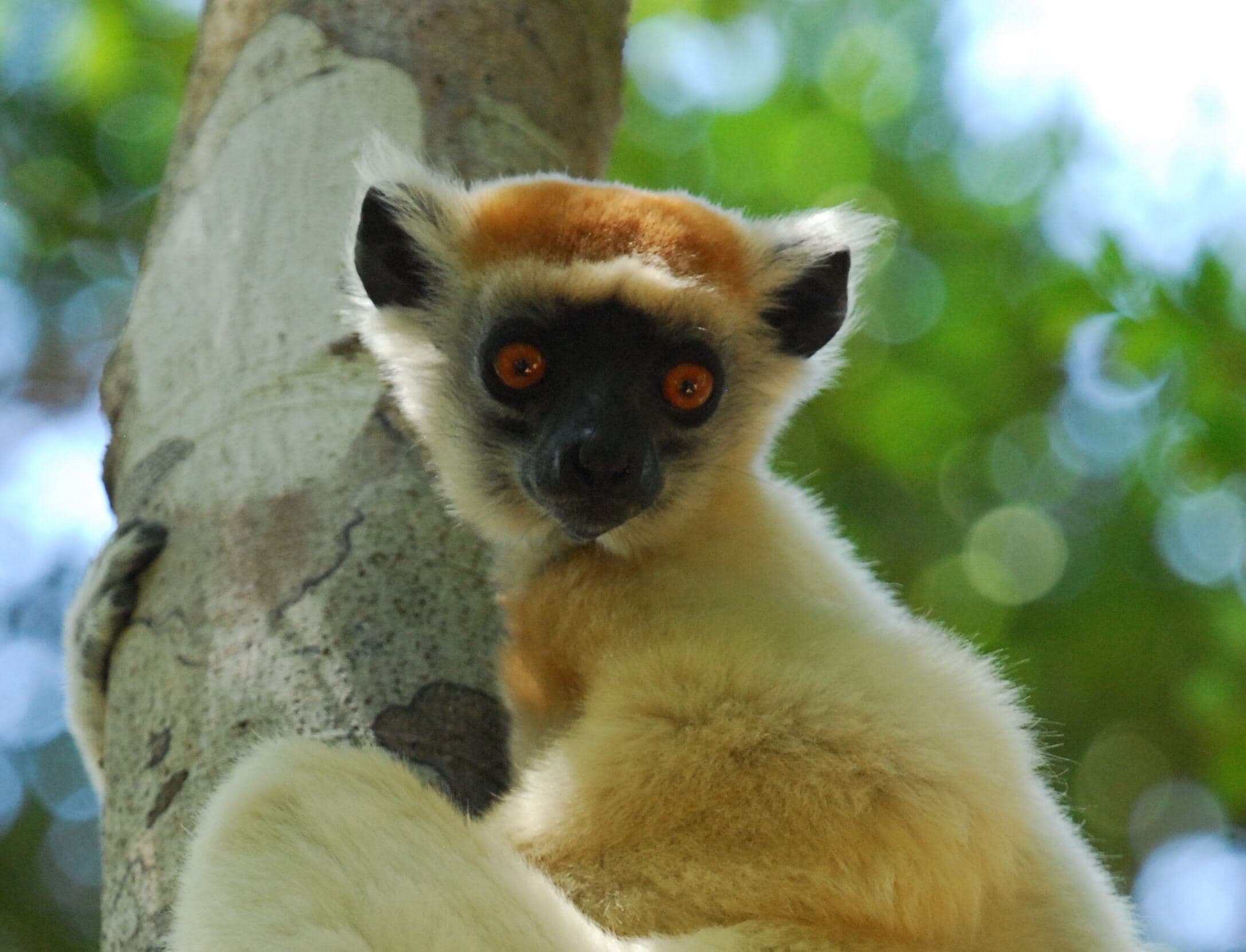
  • Golden-crowned sifaka with white fur clinging to a trunk

    Daraina – Loky-Manambato

    Bemarivo Domain, copper, gold, habitat mosaic

    How can mineral exploration, conservation and territorial governance be reconciled?

  • Ancient inscribed vase in a display case

    Vohémar

    Geology, coastline and Rasikajy archaeology

    How do bedrock, quarries, maritime networks and materials tell a shared story?

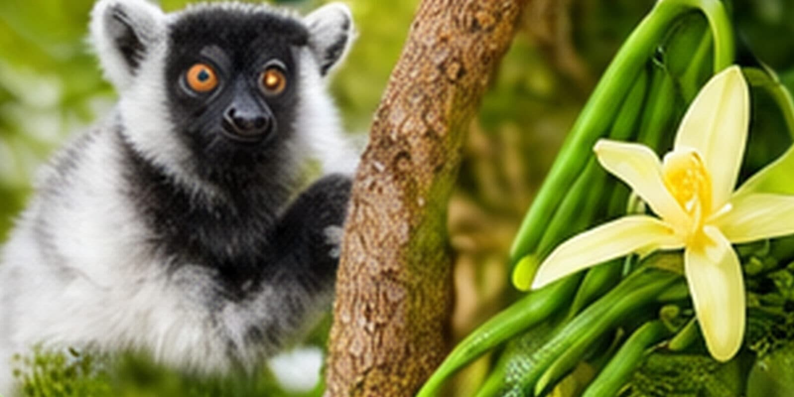
  • Lemur in the forest and a vanilla flower

    Sambava – Andapa

    Agroforestry, watersheds, rice farming, vanilla

    How can production, biodiversity, water and landscape resilience be balanced?

Limestone plateau bristling with tsingy under a cloudy sky

The signature journey, day by day

Eighteen days, adjustable from 14 to 24, designed as one continuous scientific story. Each stage pairs a scientific reading, an observation exercise and a deliverable. The final route depends on the season, road conditions, flights and permits.

Day 1 / 18Antananarivo

  1. Day01

    Antananarivo

    Arrival and MDCBridge briefing

    Start the journey with a question: how do you read a territory? Welcome, check-in, and an introduction to the corridor map, the main geological and ecological units, and the field rules.

    Scientific reading
    Madagascar within Gondwana; major geological domains; north-west / north-east climate gradients; principles of territorial analysis.
    In the field
    Setting up the field notebook and calibrating simple tools: GPS, compass, geotagged photography, observation sheets.
    Possible deliverable
    Individual mission notebook and a map of hypotheses to test.
  2. Antsiranana bay and the islet of Nosy Lonjo seen from the wooded heights

    Day02

    Antsiranana, Nosy Lonjo and the Three Bays

    Coastal geomorphology and land-sea interfaces

    Flight to Antsiranana. A panoramic reading of the bay, then a coastal circuit to the Three Bays, Orangea and Ramena, conditions permitting.

    Antsiranana bay and Nosy Lonjo

    Scientific reading
    Bay morphology, rocky and sandy shores, erosion, coastal sedimentation, and the influence of winds and human uses.
    In the field
    Visual transects, photo surveys, cross-section sketches, mapping of landform units.
    Possible deliverable
    A “landscape – process – use” plate of the Antsiranana coast.
  3. Sailing outriggers moored on the turquoise lagoon of the Emerald Sea

    Day03

    Emerald Sea

    From turquoise scenery to reef system

    Boat trip from Ramena, weather permitting. Observing lagoons, reefs, sandbanks, fishing practices and coastal dynamics.

    Emerald Sea lagoon

    Scientific reading
    Reef ecology, water clarity, substrates, pressures, uses and ecosystem services.
    In the field
    Non-intrusive observation, species log, habitat reading, short interviews with people working at sea.
    Possible deliverable
    A simplified diagnostic sheet for a marine site.
  4. Waterfall dropping into a pool in the rainforest

    Day04

    Amber Mountain

    Volcanism, water and rainforest

    A day in Amber Mountain National Park with a local guide. Crater lakes, waterfalls, volcanic relief and rainforest become an outdoor classroom.

    Waterfall, Amber Mountain

    Scientific reading
    Plio-Quaternary volcanism, introductory petrology, relief-water relationships, slope hydrology, microclimates and endemism.
    In the field
    Observing volcanic rocks and landforms without sampling, reading drainage patterns, recording altitude and humidity.
    Possible deliverable
    A “rock – relief – water – vegetation” mini-profile.
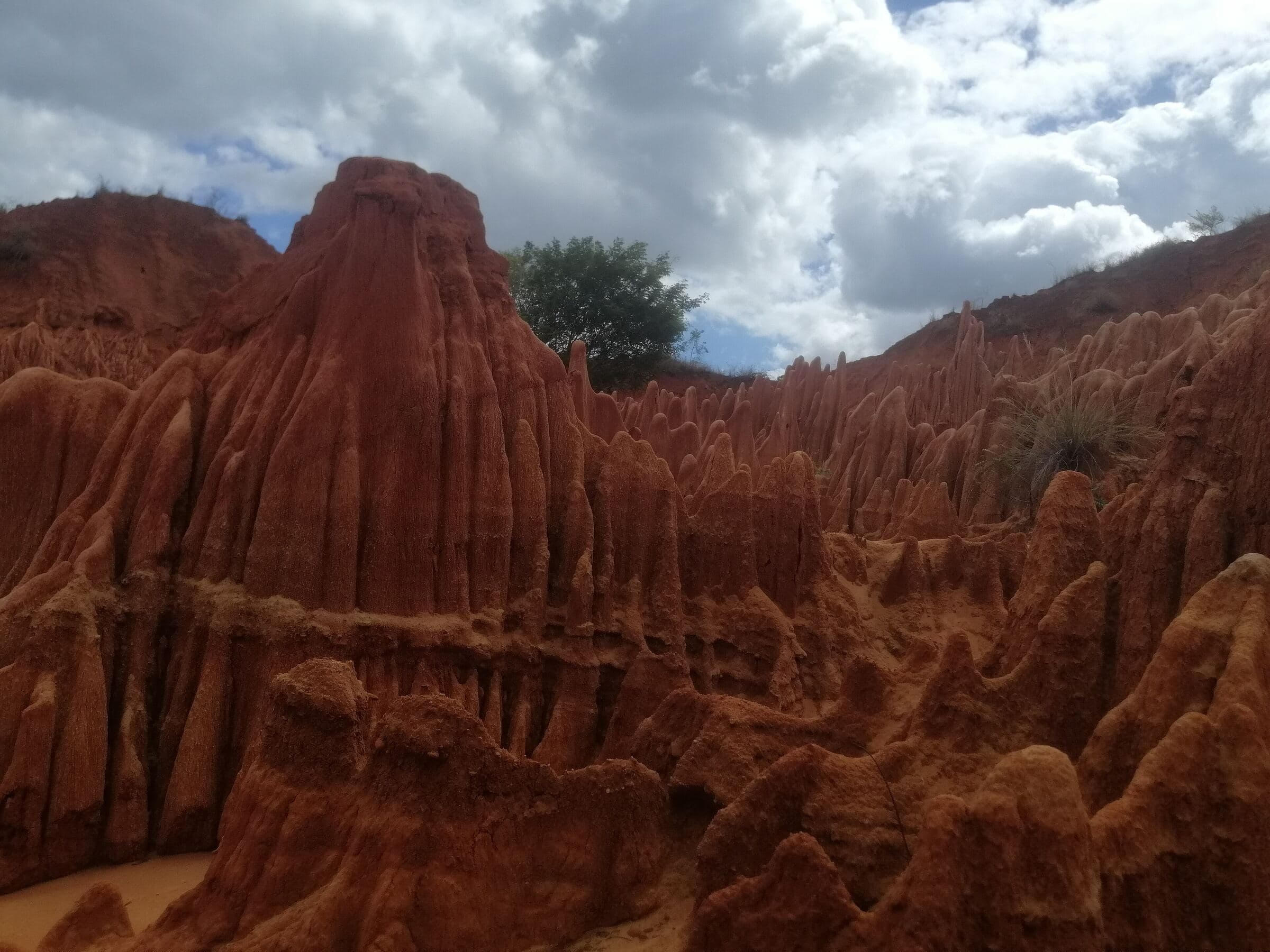
  5. Red laterite cliffs carved by erosion

    Day05

    Red Tsingy and Analamerana

    Erosion makes the landscape

    Drive to the Red Tsingy, then, permits and timing allowing, a sequence around Analamerana.

    Red Tsingy of Irodo

    Scientific reading
    Tropical weathering, laterisation, gullying, differential erosion, and the contrast between red badlands and limestone or marl substrates.
    In the field
    Sketching landforms, comparing materials, repeatable photography, discussing fragility and visitor pressure.
    Possible deliverable
    A sheet on “erosion processes and geosite conservation”.
  6. Grey limestone blades and dry vegetation in the tsingy

    Day06

    Ankarana

    Karst, caves and underground hydrology

    Guided exploration of the Ankarana Special Reserve: tsingy, canyons, sinks, caves and dry forest.

    Limestone blades, Ankarana

    Scientific reading
    Jurassic limestones, tropical karst, dissolution, underground networks, and the possible interaction between volcanism and speleogenesis.
    In the field
    Measuring fracture orientations, reading karst landforms, sketching drainage; caving only on authorised routes.
    Possible deliverable
    A conceptual cross-section of the Ankarana karst system.
  7. Day07

    Ambilobe, Betsiaka and Babano

    Mineral resources, territory and value chains

    Into the Ambilobe pilot area: gold geology and artisanal supply chains, in compliance with permits and safety rules.

    Scientific reading
    Basement / sedimentary contacts, structures, quartz-barite and associated sulphides, alluvium and reconcentration.
    In the field
    Observational mapping, reading alluvial materials, structured interviews with authorised actors; no commercial collecting.
    Possible deliverable
    A system map: resource, production, traceability, processing, income, territory.
  8. Wide river between green hills

    Day08

    Lower Mahavavy

    From geology to how the territory produces

    A cross-cutting day on water, agriculture, infrastructure and value chains around the lower Mahavavy.

    The Mahavavy at Ambilobe

    Scientific reading
    Alluvium, irrigation, river dynamics, hazards, soils, production and processing; an integrated view of multi-sector infrastructure.
    In the field
    Landscape reading, GPS points of infrastructure, value-chain interviews, identifying bottlenecks.
    Possible deliverable
    A short multi-sector territorial diagnostic note.
  9. Day09

    Ambilobe – Daraina via the RN5A

    New domain, new landscape

    The road becomes a scientific transect through changes in relief, vegetation and land use.

    Scientific reading
    Transition into the Bemarivo Domain; structural, lithological and bioclimatic contrasts.
    In the field
    Short geotagged stops at outcrops and viewpoints, safety and access permitting; photo sequences.
    Possible deliverable
    An Ambilobe-Daraina transect log.
  10. Golden-crowned sifaka with white fur clinging to a trunk

    Day10

    Loky-Manambato

    Biodiversity, micro-endemism and pressures

    Immersion in the Loky-Manambato Protected Harmonious Landscape with local guides.

    Golden-crowned sifaka, Daraina area

    Scientific reading
    A mosaic of dry and humid forests, lakes and mangroves, micro-endemism; tensions between conservation, farming, livestock and gold mining.
    In the field
    Biodiversity observation, habitat reading, exchanges with managers and communities, non-intrusive photo protocol.
    Possible deliverable
    A “habitat – pressure – actor – management response” matrix.
  11. Day11

    Daraina, Bemarivo Domain

    A Neoproterozoic arc and its metallogeny

    A geoscience day around Daraina, outside restricted zones and under land, mining and environmental permits.

    Scientific reading
    Bemarivo volcano-sedimentary groups, arc magmatism, metamorphism, copper showings; GIS, remote sensing and geophysics.
    In the field
    Outcrop description, basic structural measurements, geological photography, integration into a field GIS.
    Possible deliverable
    An outcrop log and a map of hypotheses on mineralisation controls.
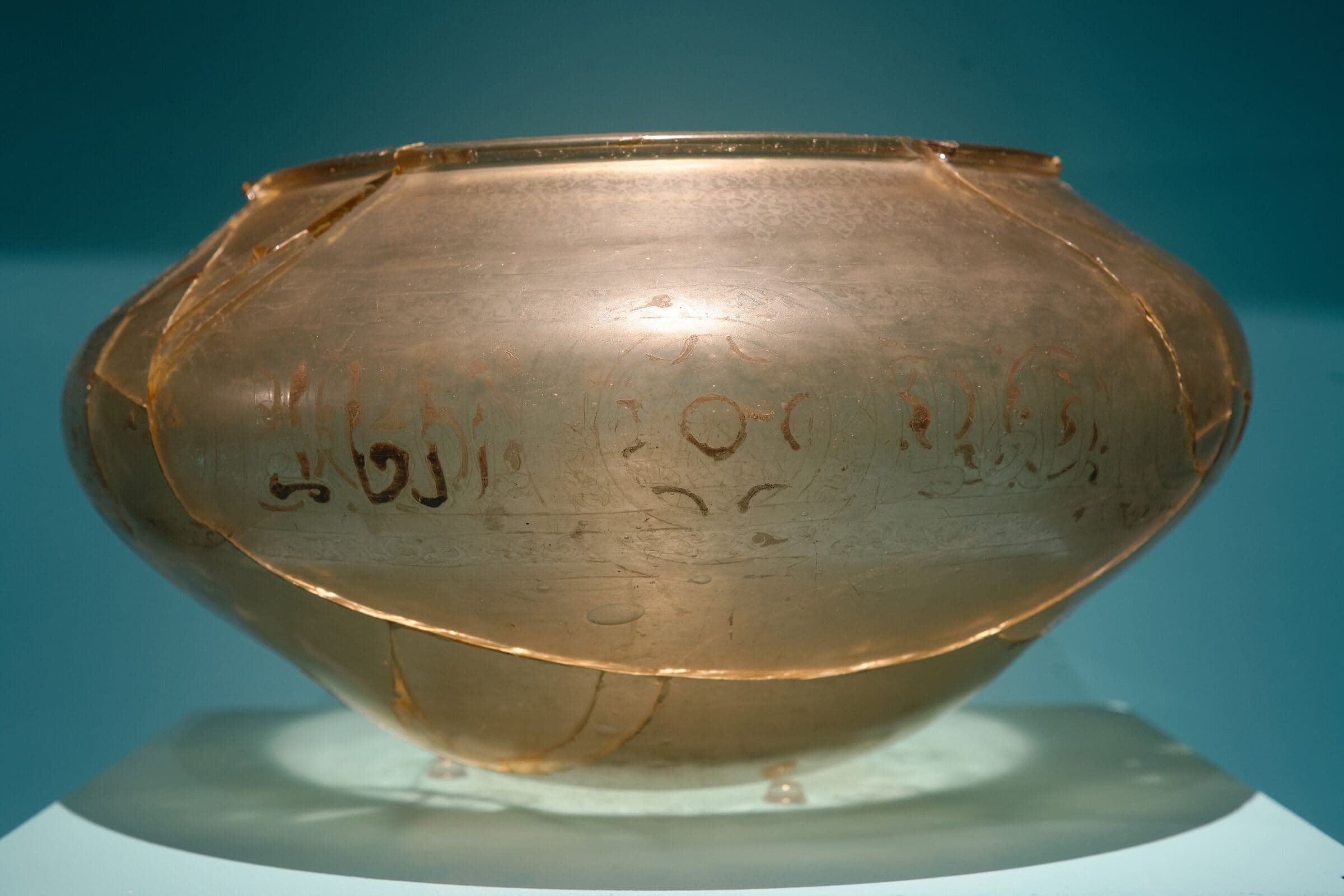
  12. Ancient inscribed vase in a display case

    Day12

    Vohémar / Iharana

    Geology, coastline and Rasikajy heritage

    Reading the coastline, the port and the geological setting, followed by a heritage and scientific archaeology sequence.

    Inscribed vase from Vohémar, musée du quai Branly

    Scientific reading
    Rasikajy heritage and Indian Ocean networks; stone, ceramics and metallurgy as technical archives.
    In the field
    A permitted heritage walk and a discussion of archaeometry and material provenance.
    Possible deliverable
    A “geology – materials – exchange – heritage” sheet.
  13. Day13

    Vohémar – Sambava

    From bedrock to working landscape

    Transfer to Sambava with landscape stops. An introduction to vanilla systems, villages and land-use change.

    Scientific reading
    Agroforestry, associated biodiversity, land-use history, soil quality, supply-chain economics and climate vulnerability.
    In the field
    Technical visit of authorised plots, interviews with growers, observing support trees, shade and soils.
    Possible deliverable
    A comparison grid of agroforestry systems.
  14. Lemur in the forest and a vanilla flower

    Day14

    Sambava

    A global supply chain seen at local scale

    A day on vanilla production, curing, quality and traceability, with local partners.

    Vanilla and forest of SAVA

    Scientific reading
    Agronomy, plant pathology, quality, agroforestry, biodiversity, supply-chain economics and traceability.
    In the field
    Plot observation protocol, post-harvest chain, sustainability indicators.
    Possible deliverable
    A vanilla value-chain map and sustainability indicators.
  15. Day15

    Andapa

    Water links mountain, rice field and town

    Drive to Andapa and study of its agricultural basin.

    Scientific reading
    Watershed hydrology, irrigation, erosion, sedimentation, rice farming, upstream-downstream links and ecosystem services.
    In the field
    Reading irrigation works, slope-to-plain transect, turbidity observations, interviews on water management.
    Possible deliverable
    A functional diagram of the Andapa watershed.
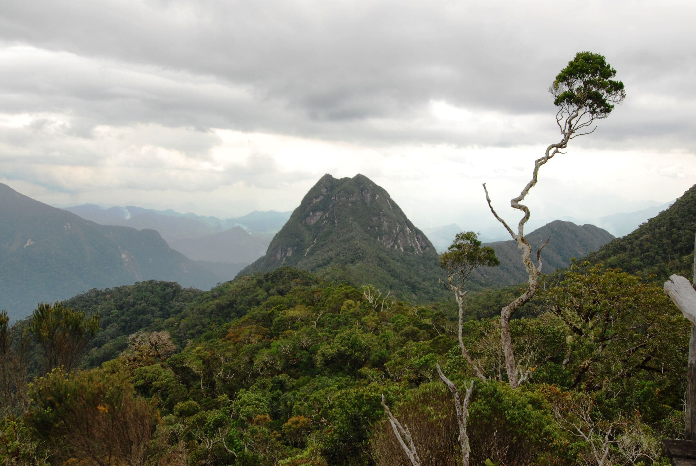
  16. Forested peaks of the Marojejy massif under a hazy sky

    Day16

    Marojejy or Anjanaharibe-Sud

    Altitudinal gradients and rainforest research

    A day, or the start of a forest module, depending on fitness, access and schedule.

    Marojejy massif

    Scientific reading
    Mountain ecology, altitudinal gradients, endemism, rainforest functioning, biodiversity monitoring.
    In the field
    Guided ecological transect, standardised observation points, non-invasive methods, exchanges with managers and researchers.
    Possible deliverable
    An “altitudinal gradient” protocol sheet.
  17. Day17

    Sambava – Nosy Be

    Reconnecting the North’s two coasts

    Back to Sambava, then a flight or combined transfer to the western arc, depending on confirmed flights.

    Scientific reading
    Remoteness, territorial continuity, and the role of cross-country links in research and regional development.
    In the field
    Mission debrief, data consolidation, choosing observations for the final presentation.
    Possible deliverable
    A consolidated field database.
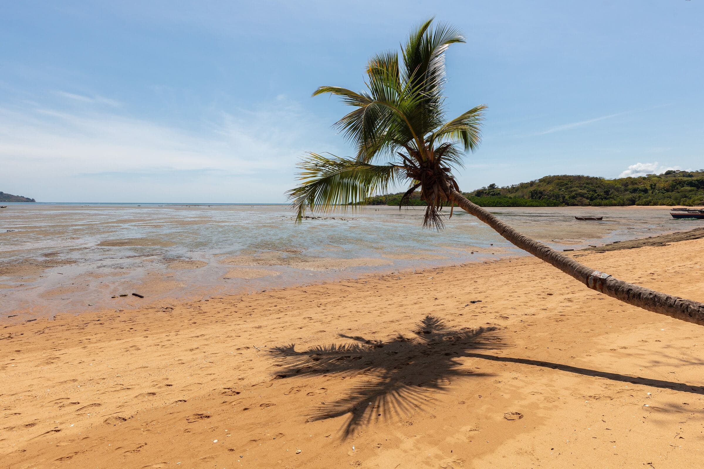
  18. Coconut palm leaning over a sandy beach at low tide

    Day18

    Nosy Be, Lokobe

    A land-sea synthesis to close

    Final sequence in Nosy Be: Lokobe or a marine site depending on the program, then departure or an extra night depending on flights.

    Ampasipohy beach, Nosy Be

    Scientific reading
    Island biodiversity, forest-coast interface, reefs, tourism pressure, governance of natural areas.
    In the field
    Biodiversity observation, discussion of carrying capacity and environmental monitoring, group synthesis.
    Possible deliverable
    MDCBridge wrap-up: 10 findings, 5 research questions, 3 cooperation proposals.

Three programs to choose from

From discovery travel to university field school, every program follows the same corridor with the same standards.

Crater lake surrounded by rainforest, Amber Mountain

18 days

MDCBridge North Scientific Discovery

Geotourism, biodiversity, territories and heritage. Rich interpretation, light fieldwork.

Curious travellers, active retirees, alumni, patrons

Lemur in the forest and a vanilla flower from SAVA

14 to 21 days

MDCBridge SAVA University Field Program

Vohémar, Sambava, Andapa, Marojejy and Anjanaharibe-Sud: geology, agroforestry, water, ecology and heritage.

Universities, field schools, laboratories

Turn the journey into a research mission

For universities and research teams, the journey becomes a logistical backbone. Each territory can take 2 to 7 extra days, with objectives, supervision, protocols and deliverables, validated with scientific partners and the relevant authorities.

Before you go

Ring-tailed lemur with orange eyes, photograph by SIFAKA Voyages

In the field with SIFAKA Voyages

MDCBridge works with SIFAKA Voyages, an agency specialising in authentic and responsible travel in Madagascar. SIFAKA handles ground logistics: transport, accommodation, guides and drivers. MDCBridge designs and leads the scientific side.

The signature journey grew out of SIFAKA’s “Northern Madagascar: a blue escape from Diego to Nosy Be” tour, extended to Vohémar and SAVA, the land of vanilla, forests and lemurs.

Let’s plan your crossing

Tell us who you are and what you want to understand. We will build the program, schedule and quote with you.

Ground partner
sifaka-voyages.com
You are

Your request reaches us directly, and a confirmation is sent to you by email.